Record-breaking heavy rains in Kyoto have caused flood damage to the Arashiyama Togetsukyo Bridge (嵐山渡月橋) and Katsura River, and the Kamo River (鴨川) has risen to the verge of overflowing.
Due to the heavy rainfall on July 5-6, special warnings for heavy rainfall and flooding were issued in Kyoto, causing damage such as landslides and paralyzed traffic networks in many areas.
In addition, evacuation orders and advisories have been issued for the Kamo and Katsura Rivers flowing through Kyoto City due to the threat of flooding.
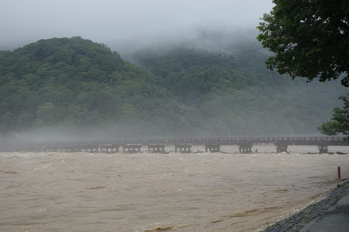
The Kamo River rose to its banks, and the Katsura River, which flows through the Togetsukyo Bridge in Arashiyama, was so muddy that it looked like it might overflow.
The normally serene scene was completely transformed, and the threat of nature was clearly demonstrated.
Please take a look at the video I shot near Arashiyama on the Katsura River and near Kawabata and Oike on the Kamo River.
This article describes the heavy rains of 2018. See below for a look at the heavy rains caused by Typhoon 18 in September 2013.
Record rainfall in Kyoto in July 2018

The heavy rains that have been continuing since the 5th have caused landslides and other damage throughout western Japan, closing national highways and expressways and suspending operations of JR and private railways.
Record-breaking rainfall was also observed in Kyoto, with the Kamo and Katsura Rivers swollen to their banks’ edges. From the 5th to the 6th, emergency disaster alerts were broadcast incessantly from cell phones, with evacuation orders and advisories issued for approximately 240,000 people in Kyoto City.
In Keihoku, Ukyo-ku, Kyoto City, the heavy rainfall reached 290 mm in 24 hours, the highest in recorded history. Nantan City, Kyotamba Town, Maizuru City, and Fukuchiyama City in northern Kyoto Prefecture also reported the largest 24-hour precipitation in July in their observation history.
Typhoon No. 18, which made landfall in September 2013, also caused significant damage due to heavy rainfall, but the current heavy rainfall may surpass it.
Kamo River flooded by heavy rains

Here is a view of the Kamo River flooded after heavy rain. This photo was taken near Kawabata and Oike.
From the Oike Bridge over the Kamo River, you can see that the water has risen to the top of the bridge piers.

The riverbank of the Kamo River, famous for the couples who sit evenly spaced along it, is flooded and is now completely submerged, obscuring everything.

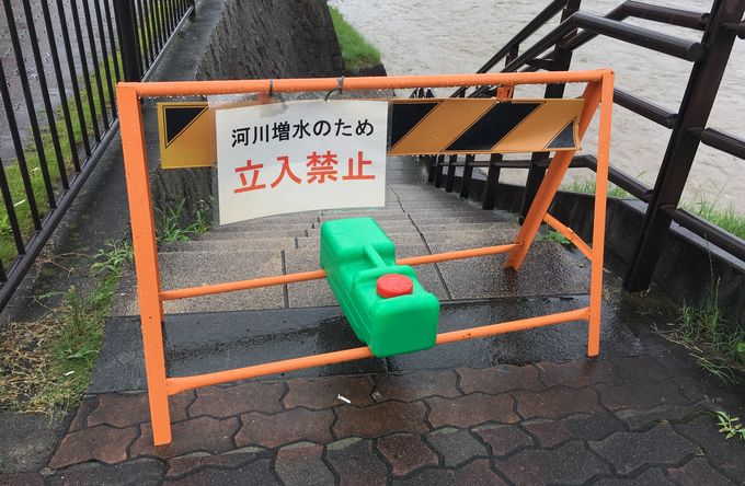
The water is approaching the steps leading down to the Kamo River bed.

Here is a view of Sanjo Bridge from Oike Bridge. The Kamo River is impressively flooded.

The riverbed of the Kamo River was off-limits due to rising water.

The revetment behind the Ponto-cho Opera House, a short distance below the Sanjo Bridge on the Kamo River, had collapsed due to the turbulent muddy water.
Sandbags were piled upstream to prevent further collapse.

The Kamo River has been a raging river that floods every few years since ancient times, as noted in an anecdote by Emperor Shirakawa: “The water of the Kamo River, the dice of Sugoroku, the mountain priests, these are the things that do not go according to my wishes.”
Even today, when flood control measures have been well implemented, the Kamo River is still inundated with muddy water when it rains heavily.
We must not forget that the Kamo River has repeatedly flooded since ancient times.
Katsura River and Arashiyama’s Togetsukyo Bridge on the Verge of Flooding Due to Heavy Rain

The Katsura River and the Arashiyama Togetsukyo Bridge are about to overflow due to heavy rain.
The Katsura River flows through the area around the Arashiyama Togetsukyo Bridge, which is famous as a scenic sightseeing spot, but when it rains heavily, the river turns into a muddy, swirling torrent.

In 2013, heavy rains caused by Typhoon No. 18 caused the river to overtop its embankments, resulting in flooding damage.

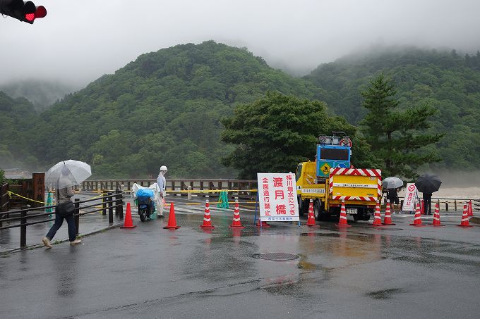
The Togetsukyo Bridge was closed due to the rising waters of the Katsura River.
The Katsura River changes its name after the Togetsukyo Bridge and is called the Hozu River or Oigawa River upstream.

The Hozu River upstream from the Togetsukyo Bridge is also closed to traffic. Muddy water is overflowing onto the road.

The Arashiyama area was passable, but the shoreline was off-limits.
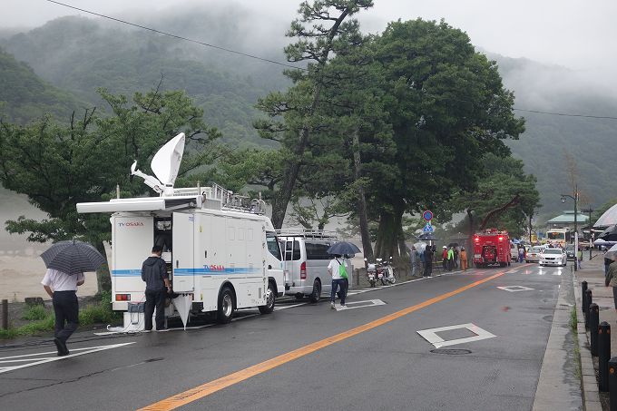
Police and firefighters are on standby, and TV stations and other media are reporting the situation of the Katsura River and Arashiyama, where the water has swollen due to heavy rains.

The Matsuo Bridge over Shijo-dori, downstream from the Togetsukyo Bridge, was open to traffic. Since the Togetsukyo Bridge was not available, we crossed it to Nakanoshima.

The water level at Nakanoshima has risen to the point that it is on the verge of flooding, and the Togetsukyo Kobashi Bridge is about to be swallowed by the muddy water.

The shoreline near Arashiyama Monkey Park was also flooded.

View of the Arashiyama Togetsukyo Bridge from Fushihara-tsutsumi.
Like the Kamo River, the Katsura River has been a raging river that has repeatedly overflowed since ancient times, and levees have been built since the time of the Hata clan, a migrant people who possessed flood control and irrigation technology.

The Fushihara-tsutsumi, built on the east bank of the Matsuo Bridge from the Togetsukyo Bridge, still protects Kyoto from the flooding of the Katsura River.
Watch for heavy rain warnings and evacuation information

A heavy rain warning was issued for the Katsura River on that day, and a request for the Self-Defense Forces was issued as the river reached the flood danger level.
Evacuation orders and advisories were issued for various areas along the Katsura and Yodo Rivers.
Heavy rain will continue in Kyoto from tomorrow onwards, and the Kyoto District Meteorological Observatory has issued a heavy rain warning for northern Kyoto Prefecture, including Nantan and Kyotamba.
The Hiyoshi Dam upstream of the Katsura River has reached its full storage level, and if heavy rains cause an increase in the amount of water released, the water level of the Katsura River will rise further.
Residents living along the Kamo and Katsura Rivers should pay attention to heavy rain warnings and evacuation information, and be prepared to evacuate if the need arises.
Japanese Article : 京都の記録的大雨 嵐山渡月橋・桂川の洪水と鴨川の氾濫


Comments Please feel free to post your comments!